
Getting Here
The Way to HOLOS Diamante: everything you need to reach the ridge: driving advice, airport transfers, suggested stops along the coast, and the maps that carry you the final few kilometres.
Welcome to HOLOS Diamante.
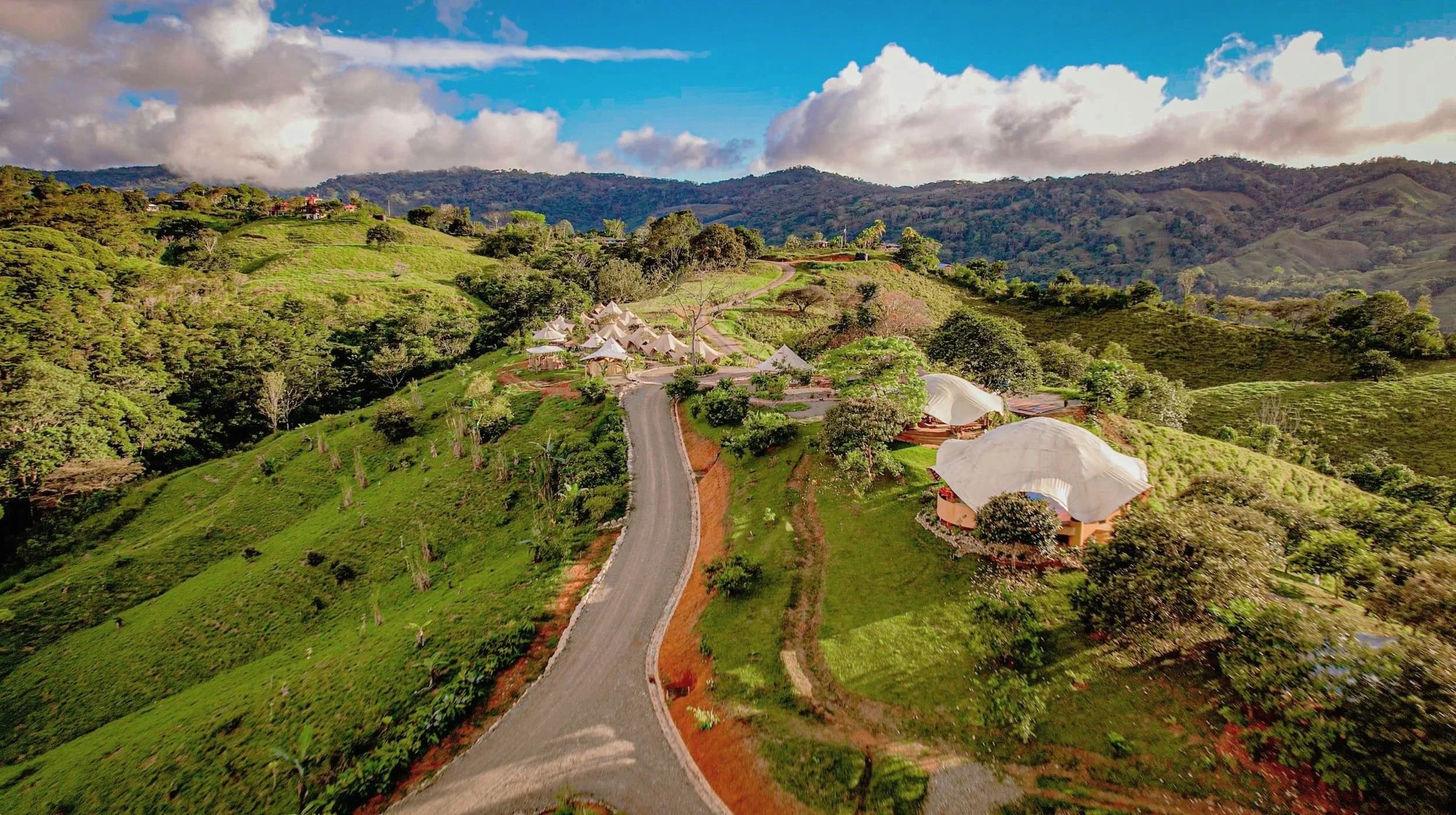
HOLOS is nestled on a beautiful ridge in the rainforest of the Diamante Valley, an ideal location with easy access to both the city of San Isidro de El General, the largest city in Costa Rica's southern zone, and the beaches along the southwest coast.
If you would like to reach Holos using your own transportation, you can insert “Holos Retreat Center” into Waze and Google Maps.
Depending on where you are traveling from, there may be multiple ways to get to Holos. We advise that you choose the routes that take you along the coast and on Costa Rican state roads; the interior routes through the mountains have windy, one-lane roads which at times can have very low visibility and often incur more volatile weather, including clouds and rain.
We recommend saving these directions on your phone or printing a hard copy for easy accessibility during your travel, as there may be areas without phone service. Be sure to start the navigation before departing on your journey.
754X+7R9
A Google Plus Code: paste it straight into Google Maps or Waze if the name search does not resolve.
Recommendations for the road.
A rural valley rewards a little preparation. These are the things our team tells every guest before they set off.
- Road conditions
While highways across the country are usually in good shape, the rural roads leading to Holos might have a few bumps along the way.
- 4x4 vehicles
Although not required, 4x4 vehicles are recommended and will be helpful for visiting our waterfall trails.
- Take the coastal route
We recommend you taking the coastal route rather than the interior routes through the mountains.
- Travel in daylight
We recommend traveling during daylight hours for extra visibility and to take in the scenic views.
- When you stop
When you make a stop, always ask your driver to lock the car and never leave valuables in the car.
- Keep fuel topped up
We are located in a rural area where there are stretches of road with infrequent gas stations. We recommend having at least 1/4 to 1/2 of gas at all times. The closest gas stations to Holos are in Dominical and San Isidro, both about 40 minutes from the property.
- Medical centers
Jacó, Quepos and San Isidro all have medical centers in case there is a need to stop for an issue. Dial 911 in the event of an emergency or car theft.
- Parking
Parking is available at HOLOS during your stay.
Costa Rica, coast to ridge.
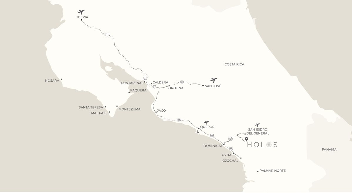
Most guests fly into San José or Quepos and drive down the coast on the Costanera before turning inland on Route 243.
- From San José Airport
San José (SJO) to HOLOS Diamante
Approximately 4 hrs via Highway 27, the Costanera Highway and Route 243.
Suggested stop spots on the way
- Soda El Guácimo, before the Tárcoles bridge
- Green Room, PuddleFish Brewery, Karma Cafe & Restaurant in Jacó
- Cafe Bohío in Playa Hermosa, past Jacó
For stop spots past Quepos, follow the Quepos recommendations alongside.
- From Quepos Airport
Quepos (XQP) to HOLOS Diamante
Approximately 1.5 hours via the Costanera Highway and Route 243.
Suggested stop spots on the way
- The Good Coffee Cafe in Pasito de Quepos
- Mama Toucans in Dominical, for groceries
- Selva Orgánica store in Platanillo
- Soda La Peña and Soda Oro Verde in Tinamastes
754X+7R9
Would you rather be driven?
Drivers our guests travel with regularly, and who know the last stretch of road well.
Tommy
Coral Reef transportation
+506 7267-6870Robert
+506 8740-9974John Mairena
+506 7285-5720
If you need support arranging for transportation please contact HOLOS Hospitality at +506 8768-2870.
UBER services are also widely available throughout the area.
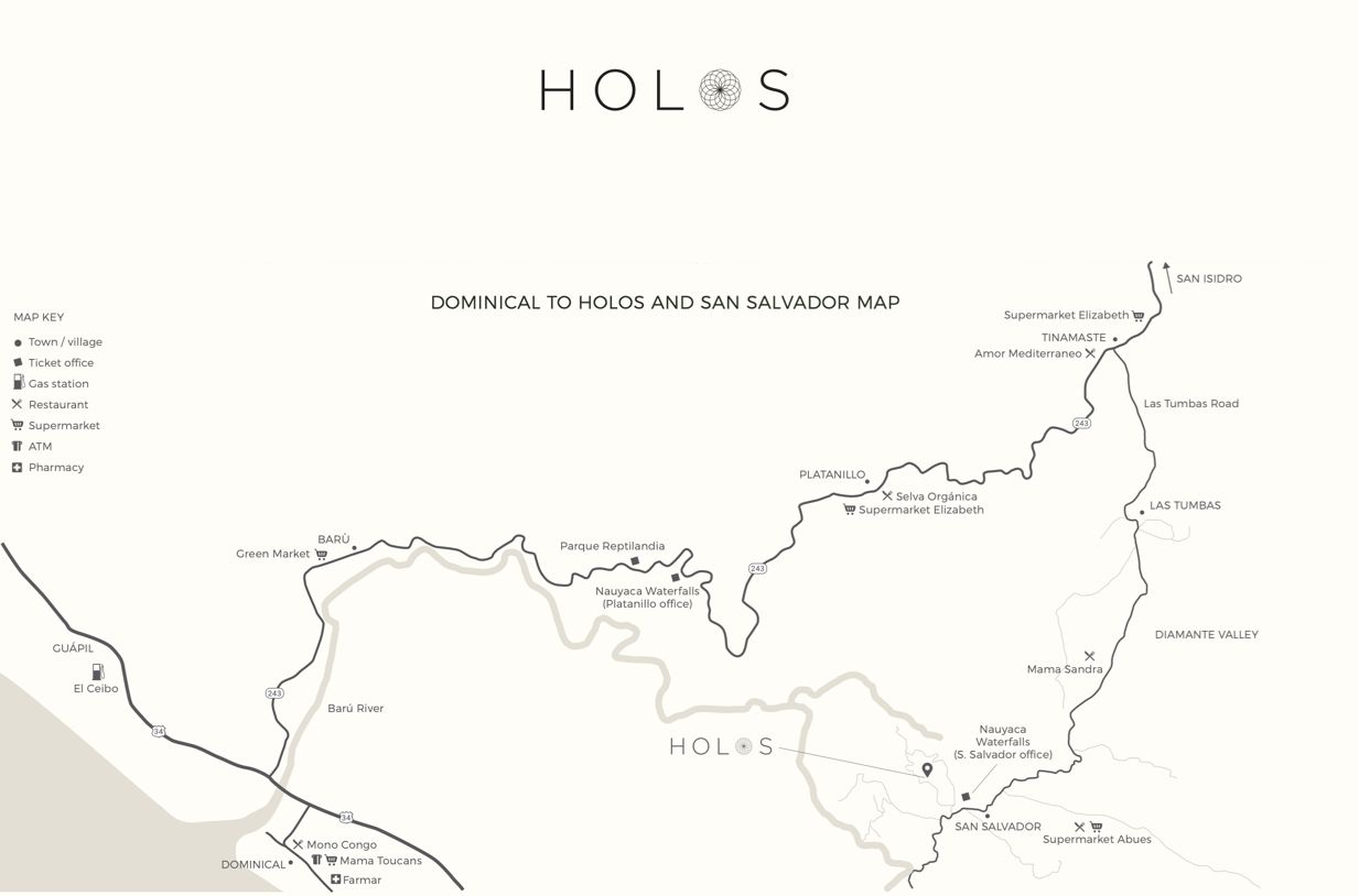
Dominical to HOLOS & San Salvador.
The stretch inland from the coast, Route 243 through Platanillo and Tinamastes, with the shops, restaurants and waterfall ticket offices you will pass along the way.
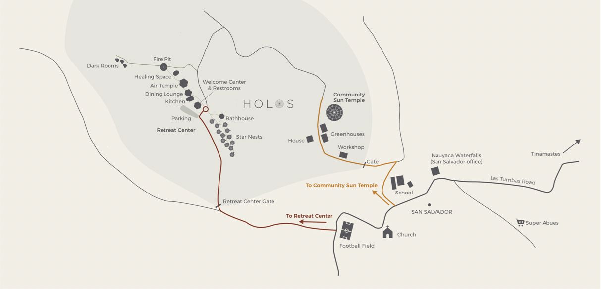
San Salvador to the HOLOS Retreat Center.
The final approach through the village of San Salvador, and the layout of the land once you are through the gate.
Keep these directions with you.
Some stretches of the journey have little or no phone service. Save a copy to your device or print one before you travel, and start your navigation before you set off.
Travelling with a group, or need help arranging transfers? Talk to our team.